In the northeast of Lower Saxony there is a huge heath and geest landscape called Lüneburger Heide. The landscape covers a huge area and contains numerous heath areas. In addition, the core of the Lüneburg Heath is protected as a nature park and may only be entered on foot or by bike. Therefore, the region offers perfect conditions for hiking and biking. In fact, even the European long-distance hiking trail E1 leads through the Lüneburg Heath. Moreover, there are over 50 other signposted hiking trails within the region. These lead through idyllic forests, magical moors, and dreamlike heath areas.
The largest heath areas are in the nature reserve Lüneburg Heath between Undeloh, Niederhaverbek and Wilsede. Especially popular sights are the Mount Wilsede and the Totengrund, which can be visited on a nice hike. I do not want to deprive you of this beautiful region in Germany. Therefore, I present you in this blog post my personal hike through the nature park Lüneburg Heath. I hope you enjoy reading my travelogue and I am glad that you visit my travel blog.
Overview of the hike in the nature reserve Lüneburger Heide
If you click on a link below, you will go directly to the corresponding section of the route. It starts in the village of Undeloh at the edge of the nature reserve and quickly leads into a coniferous forest. It is followed by the Wilseder Berg, which promises magnificent views, and by the picturesque village of Wilsede. The hiking trail continues through extensive heath areas to Oberhaverbeck, from where the route then runs in the direction of Steingrund. Afterwards you will reach the dry valley Totengrund, which is an absolute highlight in the Lüneburg Heath. The way back runs again via Wilsede along a carriage path back to Udeloh.
The entire hike through the Luneburg Heath is 21 kilometers long. I needed about 6 hours for the hike with breaks. However, there are umpteen possibilities to extend or reduce the distance. The route has no significant slope, only briefly at Mount Wilsede and Turmberg. The paths are well developed and signposted, but partly very sandy. Hiking shoes are an advantage here. There are refreshment stops on the hike in Udeloh, Wilsede and Oberhaverbeck. I have marked the route and all important destinations on the map.
The starting point of my hike and many other hiking trails in the Lüneburg Heath is Undeloh. By car you can reach the village best from the highway no. 7. The drive from Hamburg to Undeloh takes 40 minutes and from Hannover about 75 minutes. There are several parking lots in Undeloh, but you have to pay for them. The price for parking is 3 euros per day.
An alternative starting point is Oberhaverbek. There is also a parking lot for hikers. I have marked the parking spaces on the map.
By bus to the Lüneburg Heath
In Undeloh there is a bus stop called “Osterdiecksfeld”, which is served by buses from Buchholz train station or Handeloh train station. The stations can be reached with the Heidebahn, which commutes hourly between Hannover and Buchholz. On the website of the HVV or the Deutsche Bahn you can find timetables and tickets. My tip: Use the cheap DB regional day tickets* (Niedersachsen-Ticket).
Shuttlebus in the Lüneburg Heath
There is also a free shuttle bus within the Lüneburg Heath in the summer months, which goes to the region’s popular sights. You can find the timetables and the route network on the nature park website.
The most underrated hiking region in Germany – hiking tour in the Lüneburg Heath
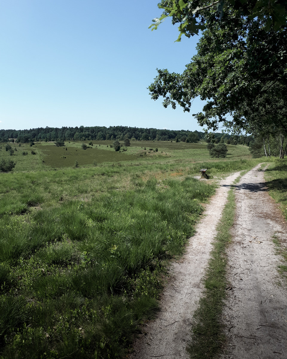
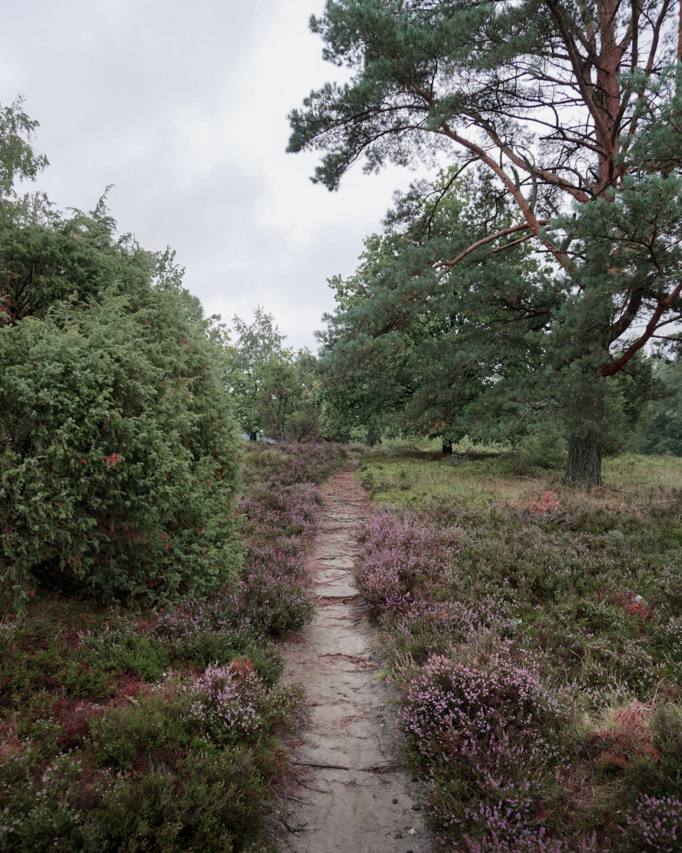
The hike starts at the large parking lot in Undeloh. Directly from here, tens of hiking trails lead in all directions of the Lüneburg Heath. I follow the European long-distance hiking trail E1, which leads me directly into the forest. This hiking trail, also called Herrmann Röhrig Weg, leads through a coniferous forest, along green meadows, and finally through the first huge area of heath.
The sights of the Lüneburg Heath: Wilsede and Wilseder Berg
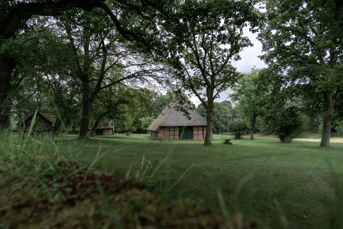
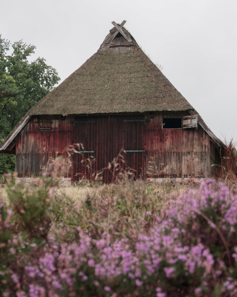
After an easy climb, I finally reach the picturesque Wilseder Berg. At 169.2 meters, it is the highest elevation in the Lüneburg Heath. From the summit you have a great view of the surrounding heathland and in good weather even a view as far as Hamburg and Lüneburg. Not far away is the beautiful Wilsede, where essential features of a pre-industrial heath village have been preserved. Accordingly, there are several sights, museums, restaurants, and hotels in the village. Wilsede can only be reached on foot, by bike or carriages, which are available in Undeloh or Oberhaverbeck.
View at the Mount Wilsede
The village of Wilsede
Short Facts for your Trip
When to go
Travel Duration
Accommodation
Transport
Equipment
Camera
When to go
Since the heather only blooms in summer, I recommend visiting Luneburg Heath in August or September. An old rule says that the flowering period lasts from 08/08 to 09/09. You can find the current flower status on the nature park website. In summer, the temperature can rise to over 30 °C. But July and August are also the months with the highest rainfall. On the following page you can find a climate table.
Travel Duration
You can tackle the presented hiking route in about 6 hours. Nevertheless, I recommend you to spend several days in the Lüneburg Heath. Take a look at the area and discover natural spectacles such as the Pietzmoor, the Osterheide or the tree top walk “Heide-Himmel”.
Accommodation
I have never stayed in the Lüneburg Heath myself, as it is close to my home. However, there is a variety of accommodations to suit all tastes. For the presented hike there is suitable accommodation in Undeloh*
Transport
In the summer months, a free shuttle bus runs within the Lüneburg Heath, which goes to popular destinations in the region. You can find the timetables and the route network on the nature park website. For bus and train I recommend booking DB regional tickets* (Niedersachsen-Ticket).
Equipment
The heath areas has little shadow, which is why I definitely recommend sunscreen and a hat in summer. Sturdy shoes are recommended for the sandy paths. You should also think of a rain jacket. Along the route there are restaurants in Undeloh, Wilsede and Niederhaverbeck, so it is not necessary to think of provisions.
Camera
The Lüneburg Heath is perfect for landscape or macro photography. But you will also meet Heidschnucken here, if you like animal photography. The best motif here are the extensive heather areas.
Flowering season in the Lüneburg Heath – hike from Wilsede to Oberhaverbeck
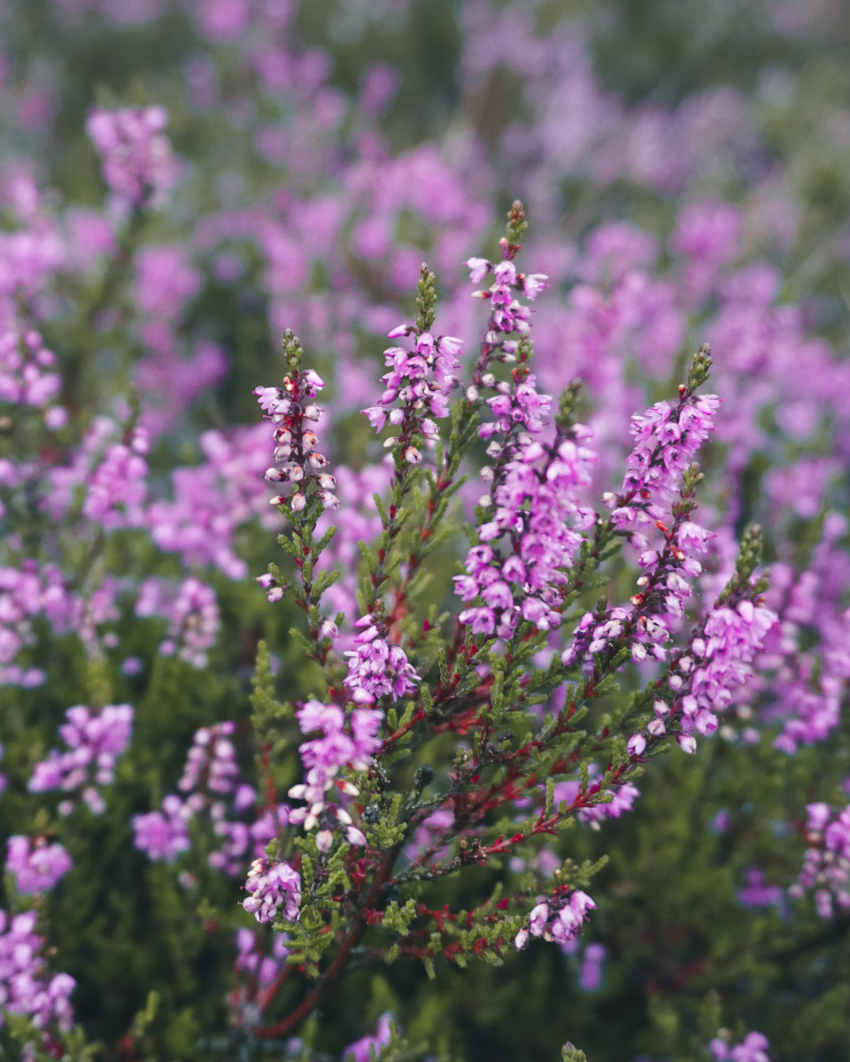
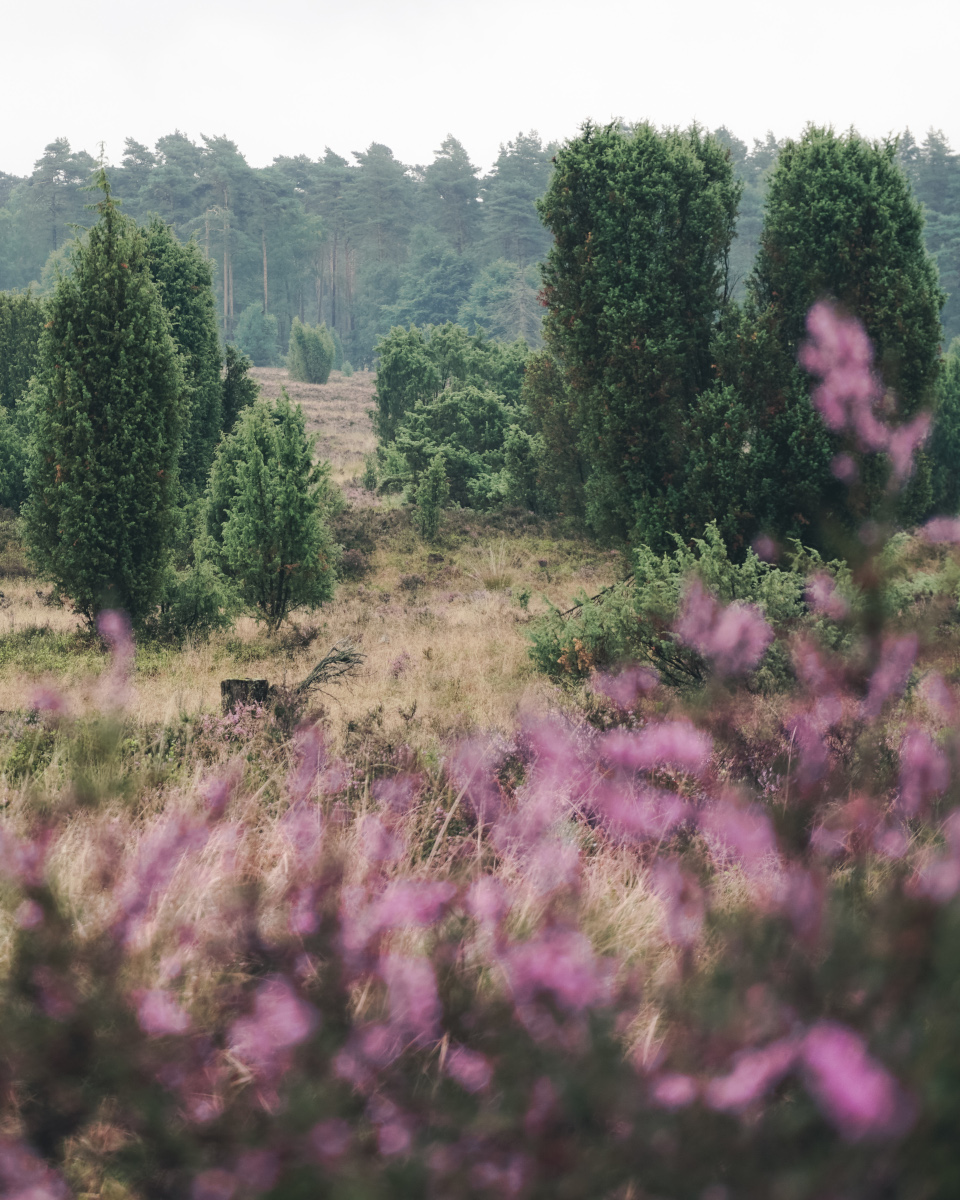
I leave the travel destination Wilsede in a southwesterly direction and first hike through the Oberhaverbecker Holz forest. At the clearing, extensive heath areas await me, which accompany me the rest of the way to Oberhaverbeck. Shortly before reaching the village, I climb the 135-meter-high Turmberg, which guarantees great views of the heath areas interspersed with juniper bushes. If you don’t want to eat, stay overnight or rest in Oberhaverbeck, you can hike directly from the Turmberg in the direction of Steingrund.
If you are looking for a travel guide to Lower Saxony, check out this book. The authors give great travel tips for the most beautiful sights in Lower Saxony. Moreover, not only the well-known sights are described, but also more unknown places are mentioned.
The hiking trail from Oberhaverbeck leads me to the right behind the Turmberg again through beautiful heath areas. Then I walk on the forest path O2 through the Oberhaverbeck Holz. At the clearing I reach the worth seeing Steingrund: a typical dry valley of the heath landscape.
Juniper and heather
Oberhaverbecker Holz
Lüneburg Heath nature experience – hike through the Steingrund
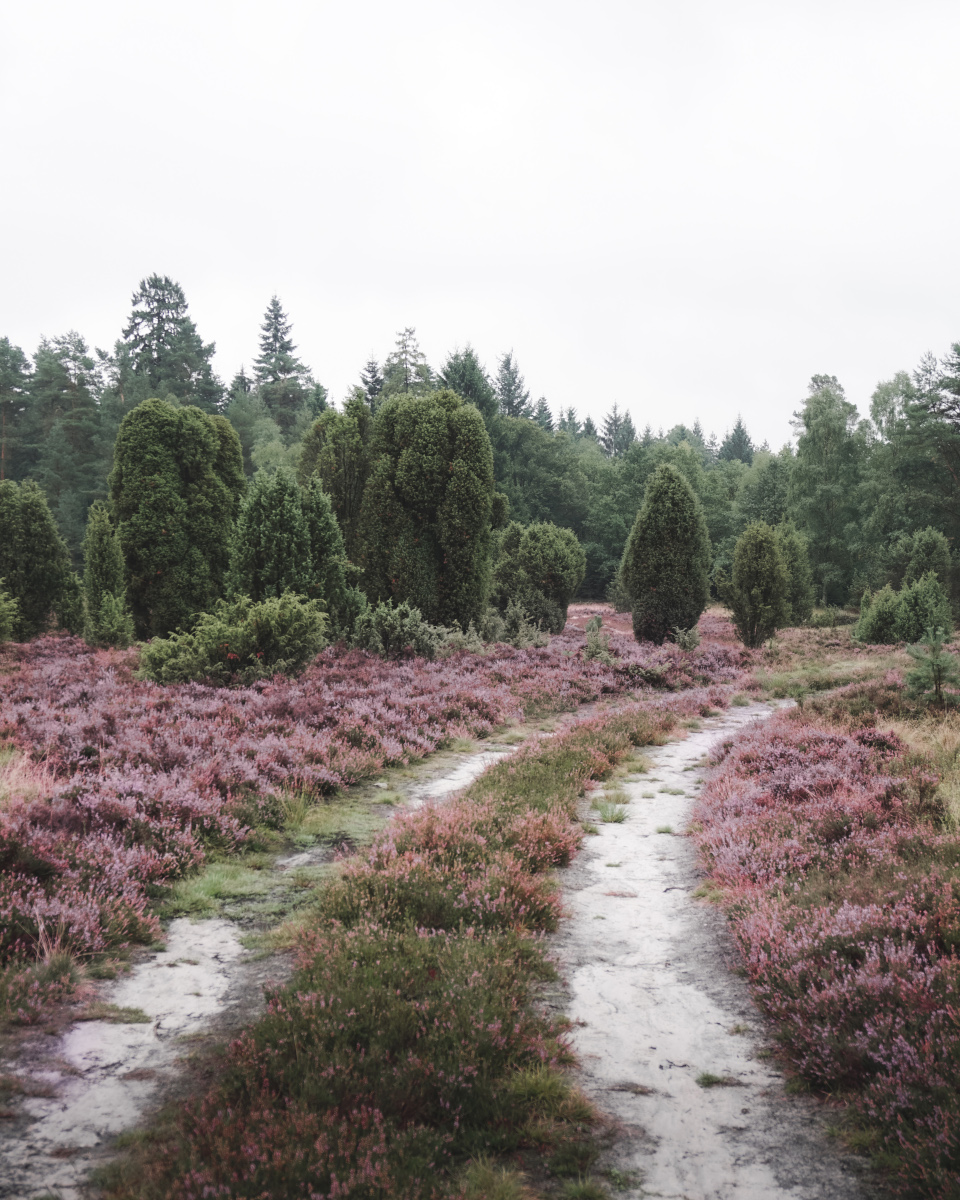
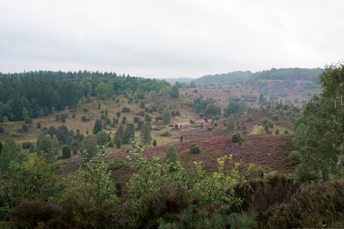
The Steingrund dry valley is surrounded by 40-meter-high ridges and contains typical features of a heath landscape. In the Steingrund you will find heath, wild juniper bushes, and countless erratic blocks. The Steingrund is a beautiful attraction in the Lüneburg Heath, but is overshadowed by the popular Totengrund. Both a hiking trail and a carriage trail lead around the Steingrund.
Hiking trail through the Steingrund
At Steingrund
According to a legend, the Steingrund was created during the quarrel of hostile giants, who fought each other with stones and sand. One group hurled sand at their opponents. The second group of giants could not see anything due to the cloud of dust that was raised and hurled the stones blindly in the direction of the enemy. But the stones flew much too far and crashed to the ground in what is now the Steingrund.
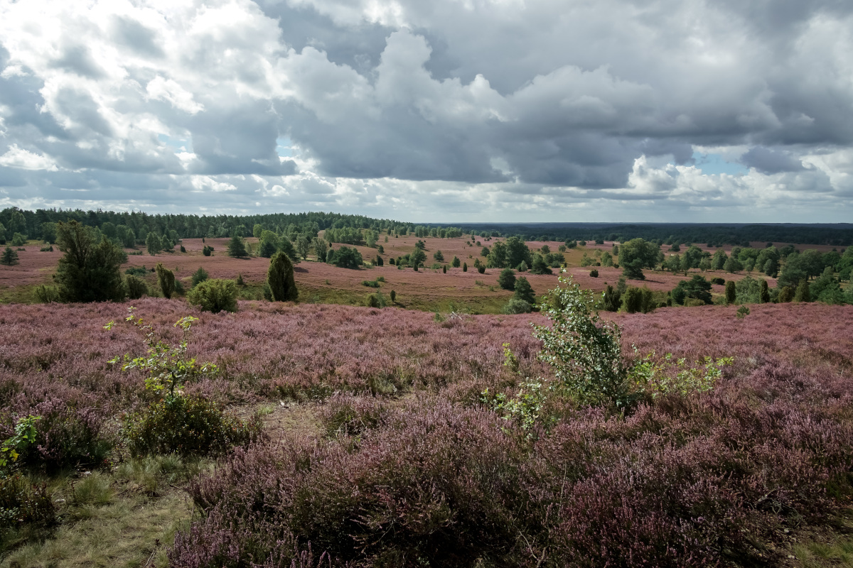
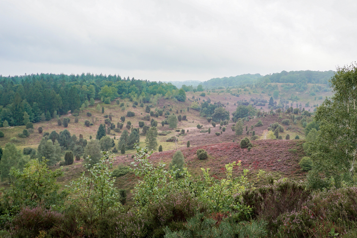
The Totengrund: The Highlight of the Lüneburg Heath
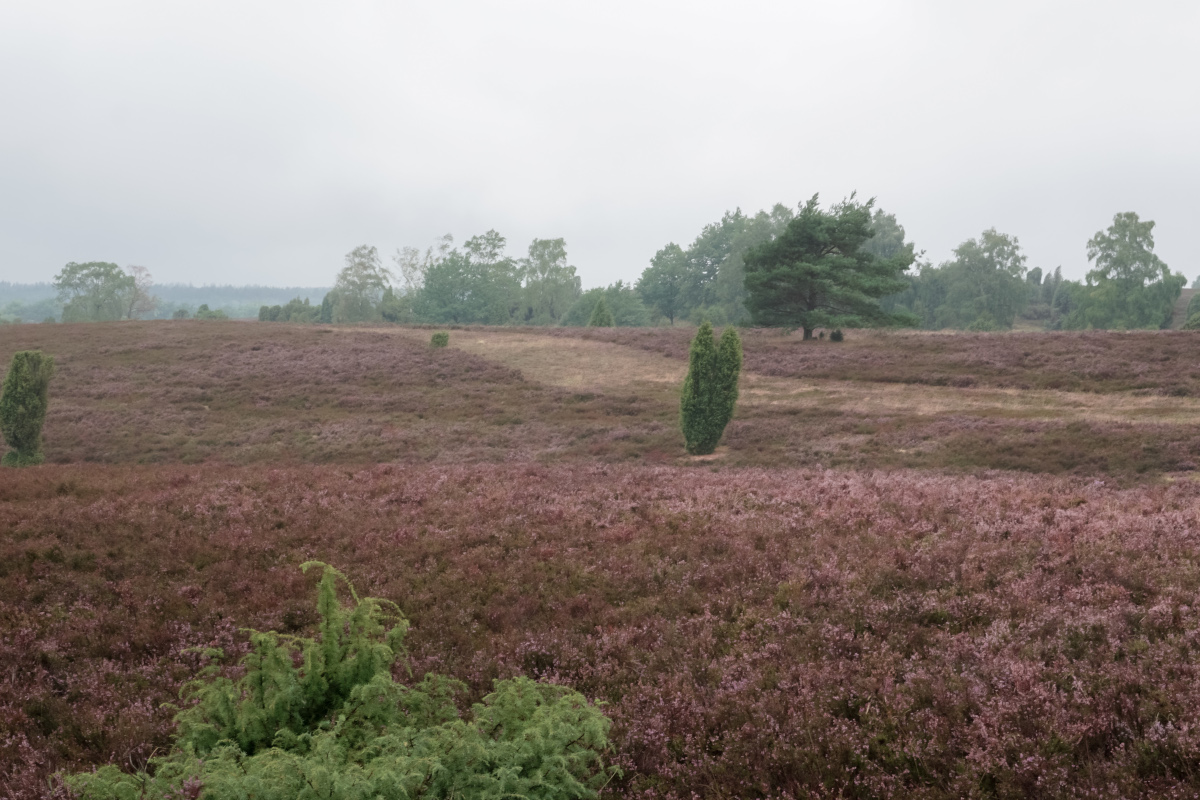
Coming from the Steingrund, the hiking trail leads me directly to the number one sight of the Lüneburg Heath. The Totengrund is a second dry valley, which is about 30 hectares in size. At the upper edge of the valley runs a great circular trail around the Totengrund. This hiking trail guarantees magnificent views of the valley, which resembles a purple sea of heather when it is in bloom. Rightly, the Totengrund is one of the most visited heath areas in the Lüneburg Heath. The valley is the nucleus of the nature reserve and is one of the first nature reserves in Germany.
The Totengrund
View at the Totengrund
If you are looking for more hikes in the Lüneburg Heath, then take a look at this book. The book is in German, but I think the hiking routes are understandable even without knowledge of German. I personally like this series of hiking guides very much. The book is small and handy, offers useful information about hiking and detailed descriptions of the hikes. It has already enabled me to discover great hikes that I would not have found without these books.
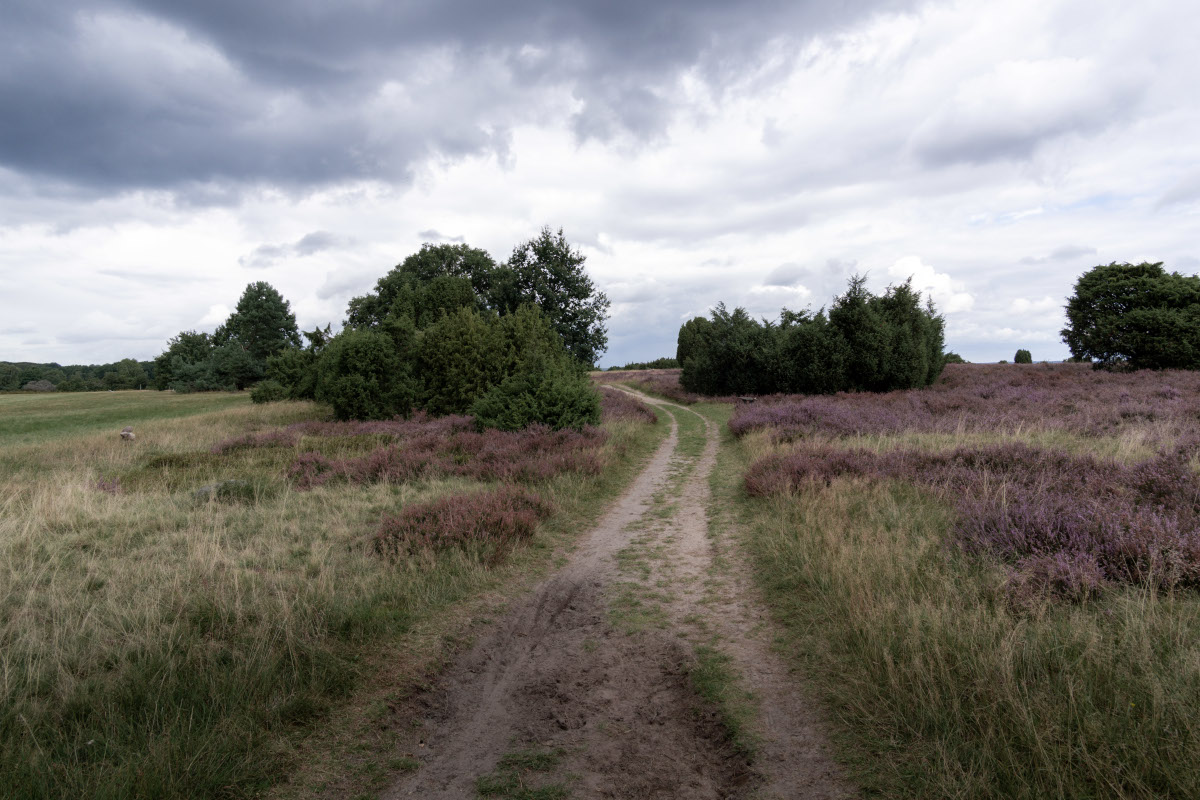
Old German hiking trail via Wilsede back to Undeloh
The last stage of the hike leads me back to Wilsede. On the way (W2) there is a sheep pen, and with a little luck you can observe a herd of Heidschnucken here. You can taste Heidschnucke in one of the restaurants in Wilsede. Heidschnucke is considered a delicacy in this region of Germany and is served with cranberries. I hike back to Undeloh via the Wilsede road, which again runs through heath areas.
Conclusion on the German nature reserve Lüneburg Heath
Overall, the route is beautiful, and I liked it very much. Anyone who appreciates nature will love this hike in Luneburg Heath. The alternation between forest, heathland, and hills and valleys makes the hike special. In fact, the Totengrund is the highlight of this hike. No relevant hiking experience is needed to complete the route, but a certain level of fitness should be present due to the length. In any case, hiking boots should be worn. The round hike is 21 kilometers long and takes about 6 hours but can be shortened if Oberhaverbeck is skipped. It is also possible to drive a part by carriage. The heath blooms from the beginning of August to the beginning of September. During this time, it is mostly sunny and hot, but there can be a lot of precipitation.
For accommodation search I recommend the platform Booking.com. Here I book most of my hotels and I have always been satisfied with the offers and prices.
The best starting point for the hike is Undeloh. In the village there are sights, bus connections, restaurants, and many accommodations. You can find a selection of accommodations under this link* Alternatively, you can also find suitable accommodations in the village of Niederhaverbeck*
Of course, there are countless other places in the region that offer accommodation. Below you will find a selection for the entire Lüneburg Heath.
I hope you enjoyed my travelogue about Lüneburg Heath. On my Lower Saxony Blog I show you other beautiful travel destinations in Lower Saxony and share valuable tips and experiences for your trip to Germany. Did you like my blog post? Was I able to help you? Then I would be happy if you recommend my travel blog, leave a comment, or follow me on Instagram. Thanks for reading and have fun on your vacation in Germany.
The references marked with an asterisk (*) are so-called commission links. If you click on such a referral link and buy something, I get a small commission from the provider. For you, the price does not change! I see it as a small thank you for my work and look forward to any support.
The display of the products was implemented with the affiliate-toolkit plugin.
We use cookies to optimize our website and service.
Functional
Always active
Technical storage or access is strictly necessary for the lawful purpose of enabling the use of a particular service expressly requested by the subscriber or user, or for the sole purpose of carrying out the transmission of a message over an electronic communications network.
Preferences
The technical storage or access is necessary for the legitimate purpose of storing preferences that have not been requested by the subscriber or user.
Statistics
The technical storage or access, which is carried out exclusively for statistical purposes.Technical storage or access used solely for anonymous statistical purposes. Without a subpoena, the voluntary consent of your Internet service provider, or additional records from third parties, information stored or accessed for this purpose alone generally cannot be used to identify you.
Marketing
Technical storage or access is necessary to create user profiles, to send advertisements, or to track the user on a website or across multiple websites for similar marketing purposes.


